Rain, strong wind gusts, 50-degree readings and a sharp temperature drop were all in the Chicago forecast Thursday, with rain transitioning to snow and “sharply reduced visibility” possible, the National Weather Service said.
Early Thursday morning, things started out on the warm side, with temperatures in the 40s and areas of drizzle and light rain, the NBC 5 Storm Teams’ Doppler radar showed.
Beginning around 10 a.m., a “fast-moving line of showers will race across the area,” the NWS said, starting in counties to the west. Those showers will move eastward, hitting most other Chicago-area counties between 12 p.m. and 2 p.m.
“This is when we start to see steady rain,” Roman said. “Maybe even some moderate downpours.”
That line will be accompanied by strong winds, with gusts reaching over 50 miles-per-hour at times.
By 5 p.m., temperatures will have plummeted, dropping into the upper 30s and high 20s. By 7 p.m., all areas will be below freezing, Roman said.
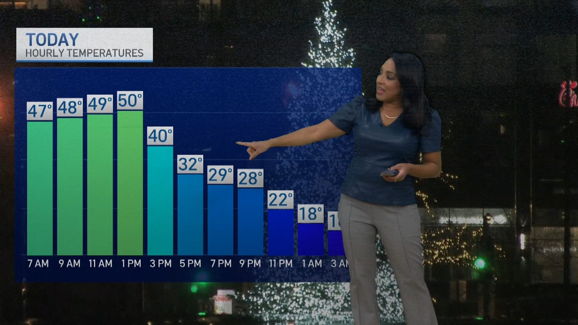
Windy conditions will continue into the evening, with drizzle and gusty rain showers transitioning to snow as temperatures fall.
“The combination of gusty winds, snow and falling temps may lead to locally slippery conditions,” the NWS said.
Windy conditions are in store through tonight. Drizzle and gusty rain showers thru early afternoon will transition to gusty snow showers this eve. Temps will fall this afternoon and eve. The combo of gusty winds, snow, and falling temps may lead to locally slippery conditions. pic.twitter.com/BzSQ269H7s
— NWS Chicago (@NWSChicago) December 18, 2025
Overnight and into Friday morning, wind chills below zero are expected, with temperatures in the teens and single digits. The sharp drop could lead to icy, frosty roads, with the NWS warning of black ice for the Friday morning commute.
[11:35 PM] While air temperatures remain above freezing and will continue to slowly rise overnight, the ground remains frozen coming out of our recent cold snap. Some untreated surfaces may become frosty/icy tonight as a result. Use caution, esp. if the ground appears glossy. pic.twitter.com/F8QgOa6Bnk
— NWS Chicago (@NWSChicago) December 18, 2025
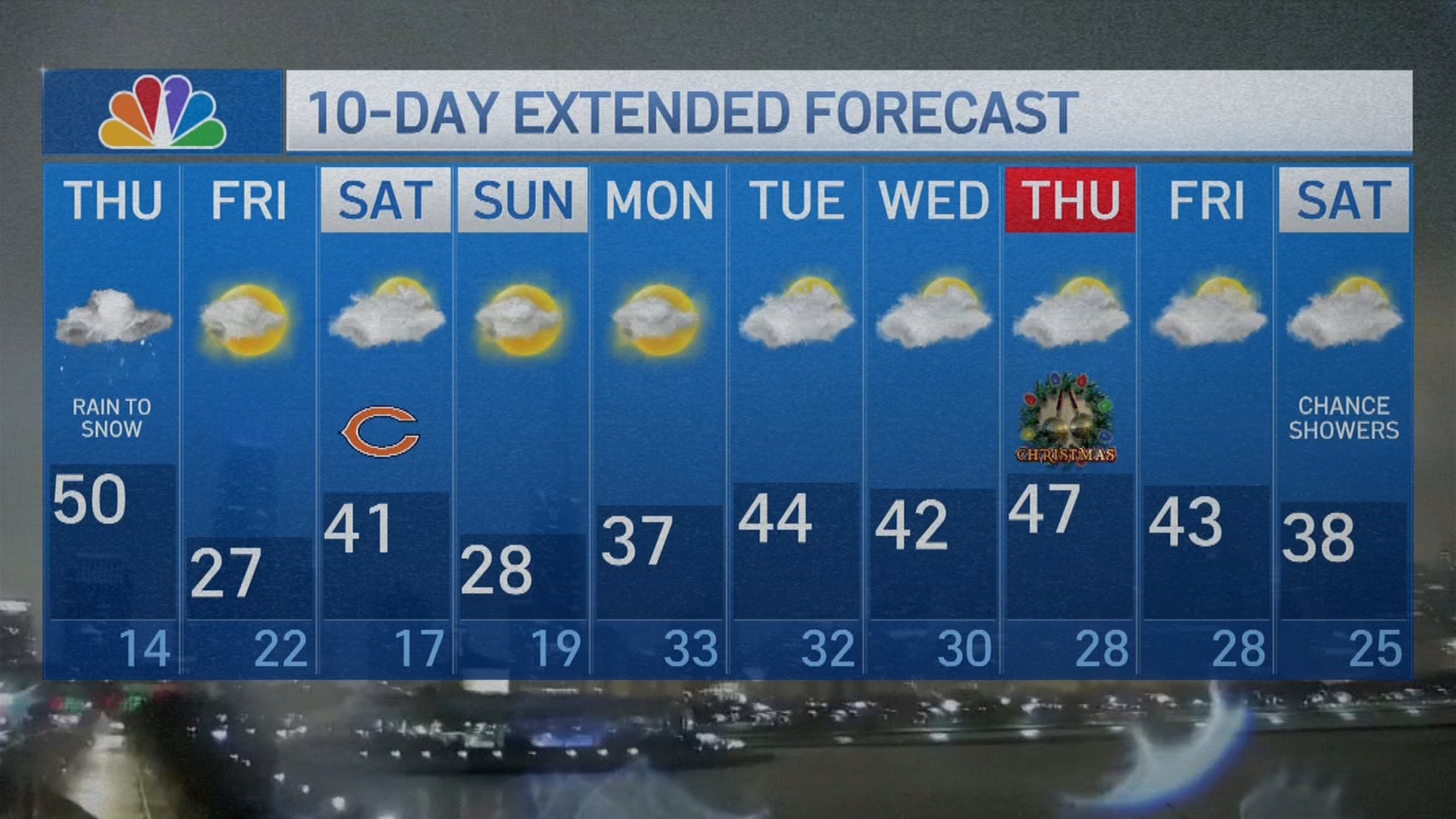
Temperatures will remain in the 20s Friday, with a brief warm-up in the upper 30s Saturday dropping again Sunday. Next week, Roman said, looks to be milder.
This story uses functionality that may not work in our app. Click here to open the story in your web browser.
![]()
Want more insights? Join Working Title - our career elevating newsletter and get the future of work delivered weekly.
