What to Know
- Scattered showers arrived Monday night before rain became more widespread overnight and into Tuesday morning.
- Downtown Los Angeles’ average rainfall for October is 0.57 inches, meaning the storm might deliver a month’s worth of rainfall or more in just a few hours.
- Flash flood watches will be in effect for recent burn scar areas, including the Eaton and Palisades fire zones.
- Roads will be slick with flooding possible in some locations during the morning drive.
- Temperatures on Tuesday will run 10 to 20 degrees below normal.
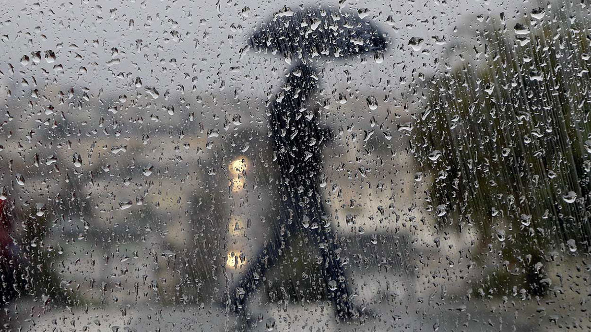
Widespread rain is expected to continue into Tuesday as the first significant storm of the season arrives, triggering flash flood watches and advisories for several areas and raising the risk of debris flows in wildfire burn zones.
Live Updates: Flood warnings, storm updates, evacuations and more
A severe thunderstorm warning was issued Tuesday morning for Santa Monica, Calabasas and Agoura Hills area. Later Tuesday morning, a severe thunderstorm warning was issued for other parts of LA, Glendale and Burbank.
Evacuation warnings were issued for some recent wildfire burn scar areas ahead of the storm. In addition to steady rain that could trigger debris flows and slides on hillsides, winds will pick up, especially in desert communities. Other possible impacts include road flooding, debris flows in wildfire burn areas, weak tornadoes and slick roads during the Tuesday morning drive.
Rain arrived late Monday night and spread overnight throughout Southern California, triggering flash flood advisories in LA and Ventura counties. The wet weather will continue into the afternoon.
“After lunchtime the activity diminishes,” said NBC4 meteorologist Belen De Leon. “Bt it doesn’t go away. We’re going to continue to see some on-and-off showers.”

A low pressure system moving south from Oregon started to deliver rain, mostly scattered showers, Monday evening. Flash flood watches, indicating the possibility of flooding, went into effect Monday night.
In Orange and San Bernardino counties, a flash flood watch will continue through Tuesday afternoon for the Bridge, Line, Apple, El Dorado and Airport burn scars. Hillsides stripped of vegetation by wildfires can make soil repel water, which can lead to increased runoff and flooding.
In Los Angeles County, the flood watch continues through Tuesday afternoon for areas near burn scars, including January’s Palisades and Eaton fires. Flooding will be possible in other areas.
Overnight into Tuesday morning
Showers picked up overnight with heavy rain developing by Tuesday morning in time for the morning drive. Street and freeway flooding is possible in low lying areas.
The forecast includes a chance for thunderstorms that could produce lightning, strong winds, hail and waterspouts or weak tornadoes.
Dr. Ariel Cohen, a lead meteorologist with the National Weather Service, said the public should prepare for the possibility of tornadoes.
“Start planning where you would be if the winds suddenly pick up or if you hear a severe weather warning from the National Weather Service,” Cohen said. “We recommend that you be indoors in a sturdy structure on the lowest floor with as many walls between you and the outside as possible. Stay away from windows.”
High rainfall rates are possible over recent burn scars, raising the threat of mudslides and debris flows. Rainfall rates could reach 0.25 to 0.50 inches per hour with higher rates possible if thunderstorms develop.
“It doesn’t take a lot of rain, especially in the burn scar areas,” Chief Sam DiGiovanna of the Verdugo Fire Academy said. “Up to a quarter inch or half inch of rain in a short amount of time can cause a mudslide.”
A few inches of snow are possible above 6,000 feet.
Tuesday’s high temperatures will feel more like winter. Expect highs to top out in the low-60s, about 10 to 20 degrees below normal.
The flood watches are expected to expire in the afternoon as rain tapers off. Spotty showers might linger into the evening with clearing by Wednesday morning.
Estimated rainfall totals and California drought conditions
Most of Southern California, including Orange County and parts of Los Angeles, Riverside, San Bernardino and Ventura counties are under severe drought ahead of the first storm of the season, according to the U.S. Drought Monitor.
A portion of western Riverside County is in extreme drought, according to the Drought Monitor report released Thursday.
The storm will mark the first significant rainfall in months for many areas. Downtown Los Angeles’ average rainfall for October is 0.57 inches, meaning the storm might deliver a month’s worth of rainfall or more in just a few hours.
- Los Angeles and Ventura counties: 0.75 to 1.50 inches
- Orange County and Inland Empire: 0.25 to 0.75 inches
- Mountains and foothills: 1.50 to 3.50-plus inches
This story uses functionality that may not work in our app. Click here to open the story in your web browser.
![]()
Want more insights? Join Working Title - our career elevating newsletter and get the future of work delivered weekly.
