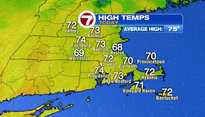
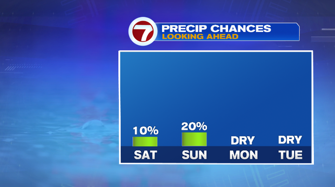
It’s been a beautiful end to our work week! Sunshine and comfortable humidity prevailed today with highs in the upper 60s/low 70s. Our weekend will be pretty nice as well. There are low chances for spot showers both days, but it stays mainly dry for most of us.
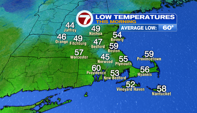
This morning we woke up to temperatures in the 40s and 50s. It will be cool again tonight with most towns falling near 50°. As the wind becomes southwest, there will be areas of patchy fog. We’ll make our way through the 60s in the morning.
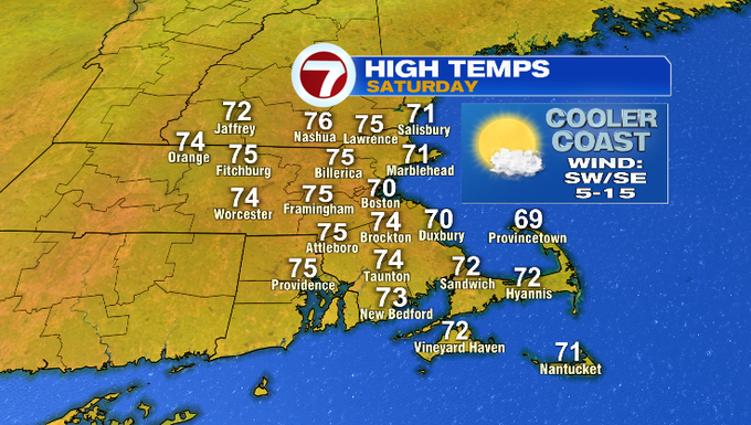
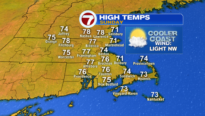
Saturday’s highs reach the low/mid 70s. Temperatures will be closer to 70° on the coast with an onshore breeze. We’ll see a lot of sun in the morning with increasing clouds through the second half of the day. Some energy aloft could help to touch off a spot shower. I have it at about a 10% tomorrow afternoon/evening.
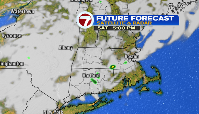
We’re still under the same pattern on Sunday – downstream of an Omega block. Some upper-level energy could drop in touching off another spot shower. Models are hinting that the best chance for this will be around southeast Mass.

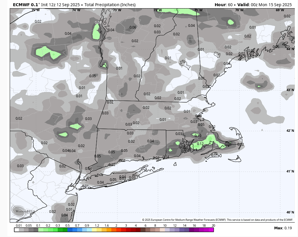
Both the Euro and NAM models expect minimal amounts of rainfall through Sunday. Most spots likely under a .10″ of rainfall.
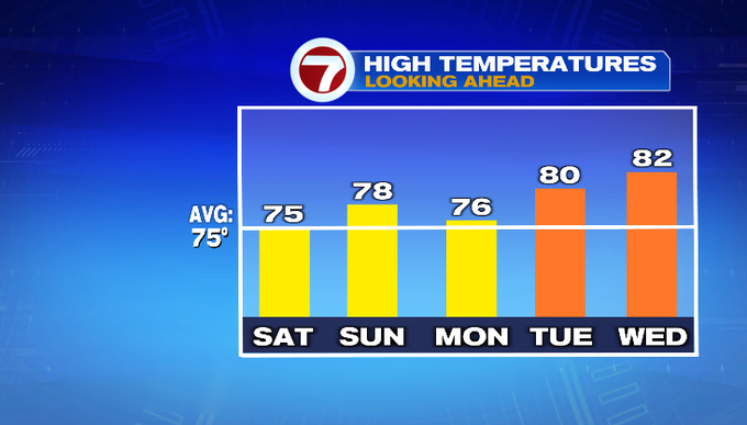
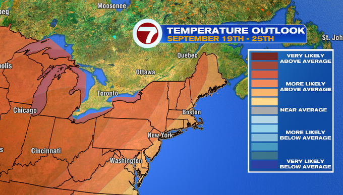
We aren’t saying “goodbye” to the 80s just yet for the season! Toward the end of our 7-day, we can expect warmer high temperatures. Looking beyond that, signs indicate for above-normal temperatures for the end of September.
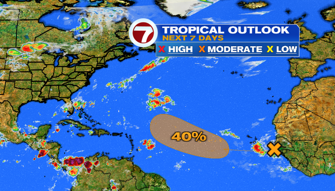
For those wondering about the tropics, it’s still fairly quiet in the Atlantic Basin. The National Hurricane Center is monitoring a tropical wave near the coast of Africa that has about 40% of development over the next 7 days. Although, dry and stable air will inhibit its development in the near term.
See you tomorrow morning on “Today in New England!”
-Meteorologist Melanie Black
![]()
Want more insights? Join Working Title - our career elevating newsletter and get the future of work delivered weekly.
